This is a postscript to my last blog in which I expressed scepticism that the land donated by the developer, Marianneville, to the Town could be valued at over $14M. This is not funny money. It is bankable. The Tax Receipt issued by the Town will be used by the developer to offset tax otherwise owing to the Canada Revenue Agency. 
The Valuation Report jointly commissioned by the developer and the Town makes several “extraordinary assumptions”.
The valuer reserves the right to
“amend, alter, or otherwise change the final estimate of Market Value should any Extraordinary Assumption contained or identified herein prove to be invalid.”
Extraordinary Assumption
One very significant “extraordinary assumption” concerns the two stormwater ponds which lie in the donated lands. The valuer says:
“These are being considered, consistent with the industry norm, on the basis of being otherwise developable.”
Here comes the health warning – I am not a valuer or a pretend valuer but common-sense tells me it is a step too far to consider the stormwater ponds developable. Against this, we are told this is the way valuers do things and it is the industry norm.
Of course, stormwater ponds are not there in perpetuity. No doubt, advances in technology make a difference. But the two stormwater ponds on the donated land (ponds 12 and 13) continue to serve a purpose. (see note 1 below)
Stormwater ponds retained elswhere
In the rest of Glenway West the two existing stormwater ponds (10 and 11) have been retained and are being incorporated into the new development. No doubt because they fulfill a function.
The Town’s Comprehensive Stormwater Management Master Plan (June 2017) goes into huge detail about how and why these stormwater ponds are needed. I learn there are approximately 100 SWM ponds in Newmarket, 58 of which are owned and operated by the Town.
Ponds 12 and 13 on the donated land are permanent “wet ponds” and provide water quantity and quality control. There is nothing in the Master Plan that suggests they are no longer needed.
The table on the right (Table 3-7) tells us more about all the ponds in Newmarket. (The graphic shows an extract with statistics on ponds 10 to 13 at the bottom.)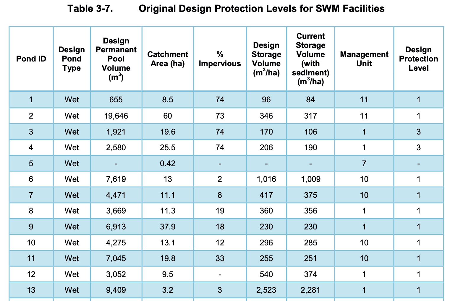
Ponds hold a lot of water
Pond 12 lies to the west of pond 13 and is the smaller of the two. Pond 12 has a design pool volume of 3,052 cubic metres and its sister to the east, pond 13, has a design volume of 9,409 cubic metres. An Olympic size swimming pool holds about 2,500 cubic metres of water.
The catchment area of pond 12 is over 23 acres and pond 13, almost 8 acres.
The valuer makes the extraordinary assumption that the two stormwater ponds are part of the 10.21 acres which are allegedly developable. If so, what happens to the water that they are designed to catch, hold and allow slowly to drain away through the soil?
Two ponds = 2.19 acres
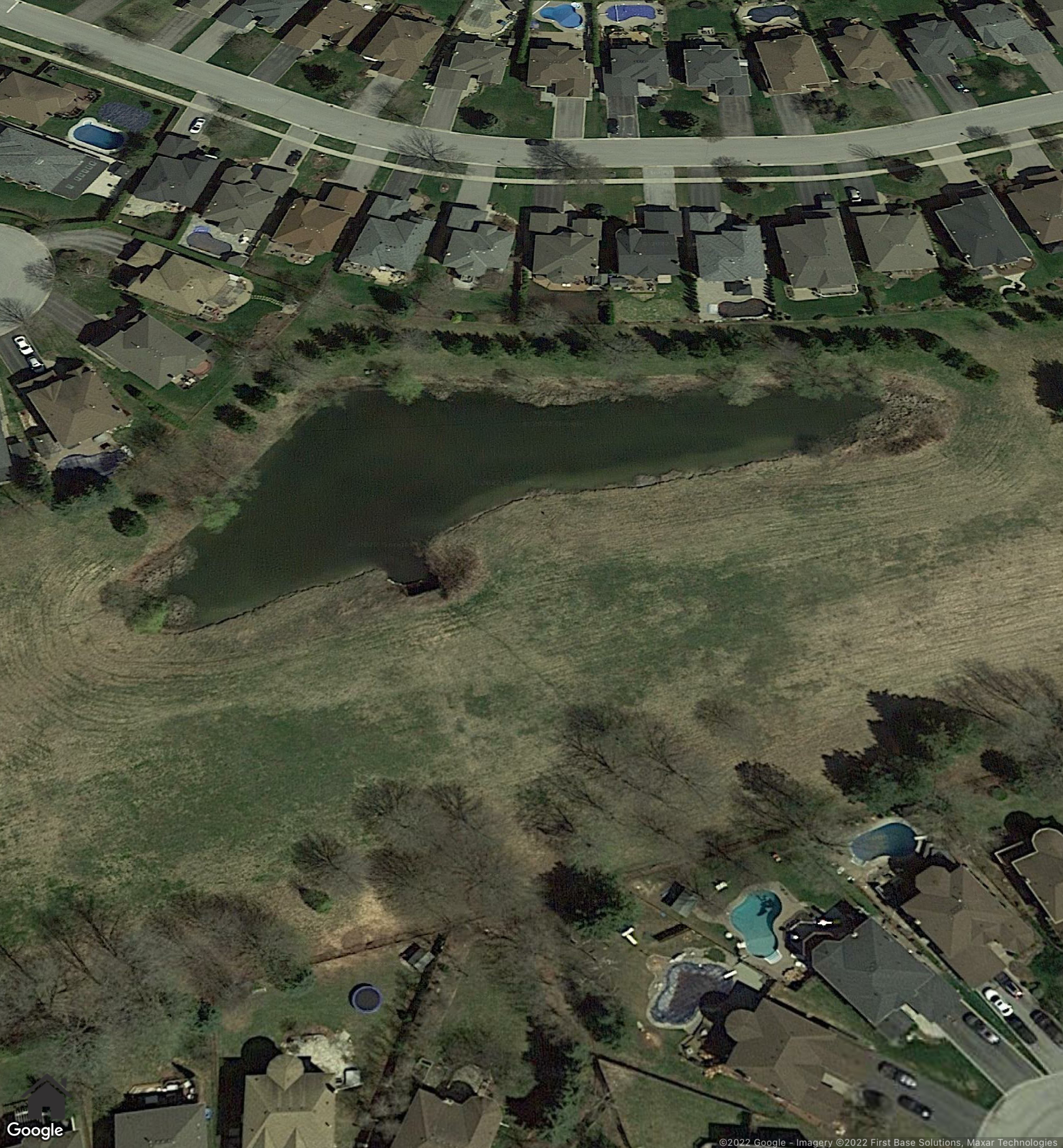
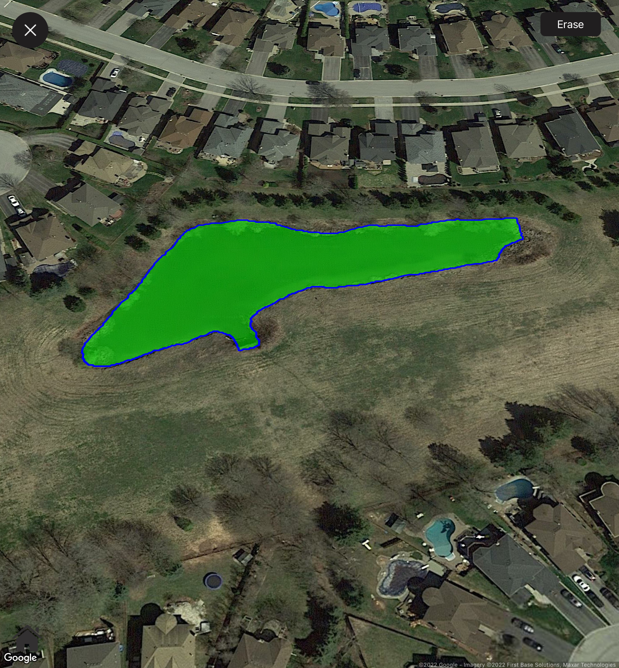
The view of pond 12 shown below in my solid green is 0.82 acres.
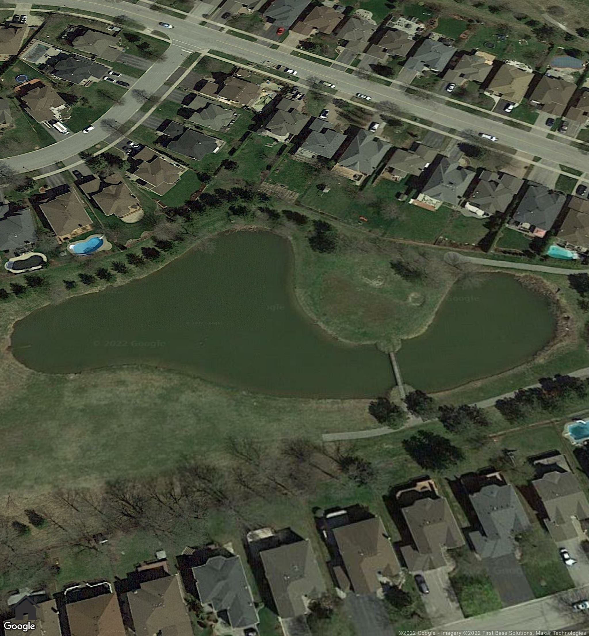
Pond 13 is 1.37 acres.
If the ponds were to remain, plainly the amount of land available for development would be reduced - along with its estimated market value.
What would the Stormwater Master Plan say?
I find it difficult to believe the stormwater ponds are developable. But if they are, how would their removal be addressed in the Town’s Comprehensive Stormwater Management Master Plan?
Seems to me the valuer's "extraordinary assumption" is invalid.
And if so, the market value of the donated land needs revision.
This email address is being protected from spambots. You need JavaScript enabled to view it.
Update on 23 March 2022: From the Canada Revenue Agency:
The onus is on charities to ensure that the fair market value reflected on official donation receipts is accurate.
Stormwater Pond 12 with the pond area calculated as 0.82 acres below:
Stormwater Pond 13 and the pond area calculated as 1.37 acres below:

The Valuation Report says the land in green below is municipal open space and is undevelopable. So the development that is theoretically envisaged by the Valuation Report would be pushed to the East towards the stormwater ponds.
